Showing posts with label transit. Show all posts

Friday, April 13, 2012

Amtrak On Pace To Set Ridership Record; Stresses Need For New Rail Tunnels

Amtrak is on pace to set to set another annual ridership record as passenger counts across its national network for the first six months of fiscal year 2012 (October 2011-March 2012) are up 3.7% over the same period last year when the current record was established. Amtrak has set ridership records in eight of the past nine years, including last year, when it carried 30.2 million passengers. Ridership along the Northeast Corridor (Boston to Washington D.C.) has increased 5.2% from the same point last year, and the Keystone Service (New York to Harrisburg) is up 4%. Since 2000, Amtrak's overall ridership is up 44%.

In applauding these gains in ridership, however, Amtrak President and CEO Joe Boardman stressed the need for more infrastructure investment, particularly along the Northeast Corridor (NEC). Boardman highlighted Amtrak's Gateway Program, which the railroad corporation hopes to complete by 2025, and is a key part of Amtrak's efforts to increase capacity on the over loaded NEC. The long-term plan is to build a new high-speed rail route along the NEC that would allow trains to make the 426-mile trip from Boston to Washington D.C. in 3 hours and 23 minutes. Presently, Amtrak's Acela Express currently makes the trip in 6 hours and 37 minutes.

"Amtrak achieving ridership records is important, but it is more critical that the right infrastructure be in place to continue this trend in the years to come and provide safe, efficient, and reliable rail transportation for all current and future passengers," Boardman said. "To do this in the Northeast, we must advance our proposed Gateway Program, as it is essential for the future growth and economic development of the region."

Amtrak is seeking $35 million this year from Congress to advance plans for its $13.5 billion Gateway Program, by adding two tunnels under the Hudson River, replacing the century-old Portal Bridge near Newark, NJ, and expanding Pennsylvania Station in New York City. As Boardman noted, "We're out of space - in the tunnels, on the tracks, in Penn Station". Boardman explained that the NEC is expected to see significant increase in demand as population in this corridor grows, highway and airport congestion worsens, and gas prices rise. The Gateway Program is Amtrak's response to these conditions.
Friday, March 16, 2012

U.S. Senate Passes Two-Year Transportation Funding Bill

On Wednesday, March 14th, the U.S. Senate passed S. 1813, also known as the Moving Ahead for Progress in the 21st Century Act (MAP-21). The bill written by U.S. Senators Barbara Boxer (D-CA) and James Inhofe (R-OK), and passed the U.S. Senate by a vote of 74-22. MAP-21 would spend $109 billion over two years to fund the nation's highway and transit systems. This amount is equal to current transportation funding levels plus inflation. Some other major provisions of the bill include:

- Consolidates the number of federal transportation programs from about 90 down to less than 30, to focus resources on key national goals and reduce duplicative programs
- Eliminates earmarks
- Improves the existing Congestion Mitigation and Air Quality Program (CMAQ) by including particulate matter as a pollutant and requiring that large metropolitan areas develop a performance plan to ensure that CMAQ funds are being used to improve air quality and congestion in those regions
- Maintains the Transportation Enhancements (TE) program and offers more flexibility to states who use these funds
- Creates the National Freight Network Program, which consolidates existing programs into a focused freight program that provides funds to states by formula for projects to improve regional and national freight movements on highways, including intermodal freight connectors
- Modifies Transportation Infrastructure Finance and Innovation Program (TIFIA) by increasing funding for the program to $1 billion per year, increasing the maximum share of project costs from 33% to 49%, and setting aside funding for projects in rural areas on more favorable terms
- Extension of the federal transit benefit parity, which expired at the end of 2011, allowing transit users a tax-free deduction of up to $240 from their paychecks for expenses incurred traveling to work
- Establishes performance measures that will hold states and metropolitan organizations accountable for improving the conditions and performance of their transportation assets

For further information on MAP-21, the U.S. Senate Committee on Environment and Public Works has put together an overview the bill's various programs, linked here

AASHTO Executive Director John Horsley hailed the passage of MAP-21, and noted that, "Members of the U.S. Senate are to be commended for their strong, bipartisan passage of a multi-year, $109 billion surface transportation reauthorization bill that sustains highway and transit funding at current levels."

MAP-21 now moves on to the U.S. House of Repesentatives, where recent efforts to pass a 5-year transportation authorization bill have fallen apart.

Friday, February 17, 2012

Before the Interstate Highway System

The Interstate Highway System is the largest public works project in history and often lauded as one of Dwight D. Eisenhower’s major achievements. It is crucial to our country’s transportation needs, about one-third of all miles driven in the U.S. use the Interstate system. Today, the transportation debate focuses on updating our rail network and fixing the crumbling roads and bridges so that we can put Americans back to work.

As we continue to ponder how this country will move forward, it is interesting to look back on our past and see just how far we’ve come. Here is a map of the US's (pre-interstate) transcontinental transportation network in 1918, color coded by individual “auto-trails”


This map is from the American Automobiles Association and shows what our cross-country road infrastructure looked like before our massive investment in the Interstate Highway System. It depicts the main auto trails of the day. The auto trail system was an informal network of marked routes that existed in the United States and Canada in the early part of the 20th century. Marked with colored bands on telephone poles, the trails were intended to help travelers in the early days of the automobile. Our transportation network has sure come a long way since then.

What will our map look like a hundred years from now?

Friday, January 20, 2012

White House and U.S. DOT To Expedite Projects Along Amtrak's Northeast Corridor

On Friday, January 13, the White House Council on Environmental Quality (CEQ) and the U.S. Department of Transportation announced a pilot program aimed at fast-tracking environmental reviews along Amtrak's heavily traveled Boston-to-Washington D.C. rail corridor. Under this program, CEQ and U.S. DOT will work with local elected officials and stakeholders to speed the environmental review process, which will help determine possible service types and station locations along Amtrak's Northeast Corridor (NEC). The pilot program calls for involving federal, state, and local governments, as well as the public, earlier in the environmental review process to set benchmarks that maintain "rigorous" environmental protections, while also saving time and money by avoiding conflicts and delays in later project-development steps, according to the CEQ and U.S. DOT.

Several major upcoming projects along the corridor that could benefit from these expedited reviews include the proposed Gateway Tunnel from Secaucus, NJ to New York City's Penn Station and upgrades to Great Depression-era overhead wires that power Amtrak trains through NJ. The proposed multi-billion dollar Gateway Tunnel was supposed to be built by 2020, but thus far has only received $15 million for engineering and design. The new tunnel under the Hudson River would support an additional 13 NJ Transit trains during peak hours and an additional eight Amtrak trains an hour. U.S. DOT has already obligated $450 million to replace overhead catenary train wires and upgrade the electrical system on the NEC between New Brunswick, NJ to just south of Trenton, NJ. The upgrades would allow trains to operate at speeds upwards of 160-mph and will increase reliability on a rail line where sagging or downed wires cause numerous delays.

The U.S. DOT will post and track project timelines and progress on the "Federal Infrastructure Projects Dashboard" at www.performance.gov

"By bringing all involved parties to the table earlier in the process, we will do the job better and finish it sooner," U.S. DOT Secretary Ray LaHood said in a statement.

Amtrak President and CEO Joseph Boardman noted, "the decision to expedite the federal environmental review process for NEC high-speed rail projects is great news for all users of the NEC who are seeking increased passenger-rail capacity, mobility and connectivity in the region. A faster review process will help speed along Amtrak’s efforts to rebuild and improve today’s corridor and advance Amtrak’s vision to develop a new high-capacity, 220 mph next generation high-speed rail system serving the region, including our Gateway program to bring more track, tunnel and station capacity into the heart of Manhattan.”

To view the full press release from U.S. DOT and the CEQ, click here

Thursday, October 6, 2011

Slick New Website Lets You Find Your Next Apartment Based On Commute Time

No one likes a long commute. In fact, it’s probably killing you. As this country’s infrastructure continues to crumble around us, Americans are faced with the very real possibility that our commutes may get even longer and more costly. If you’ve had enough and are ready to pack it all up and move closer to your workplace then the creators of WalkScore.com have just launched the service for you.

WalkScore.com is a popular website that allows you to enter in an address and determine how walkable the neighborhood is. They have taken this service to the next logical step with Walk Score Apartment Search.

This new service, currently in beta, allows the user to type in their workplace’s address and a desired commute time and responds with a list of available apartments that fit the bill. The results can even be sorted based on distance by public transit, car, bicycle, or walking. The video below explains in more detail:


Walk Score Apartment Search is available now, and is sure to be a great service for those looking to cut down on their daily grind.


Thursday, September 29, 2011

CSX Corporation Works To Limit Carbon Footprint

CSX Corporation, one of the nation's leading freight rail and intermodal transportation companies, today announced the results of its participation in the Environmental Defense Fund's (EDF) 2011 Climate Corps program. This collaborative effort places specially-trained graduate students, known as "fellows" under the EDF program, from the nation's leading universities and colleges into a three-month fellowship with major employers to addresss climate-change related issues, such as reducing carbon emissions and improving energy efficiency. With a transportation network that extends 21,000 miles in 23 eastern states and the District of Columbia, connecting 240 short-line railroads and 70 ocean, river, and lake ports, CSX is one of the largest businesses to participate in the program.

In 2011, CSX and an EDF Climate Corps fellow examined the company's railyard air compressors and the CSX Data Center in Jacksonville, Florida. Using data gathered from both the railyard and the data center, he helped CSX to identify potential cost savings of $1.2 million and greenhouse gas emissions of savings of nearly 3,000 metric tons annually.

This marks CSX's second year of participation in the EDF Climate Corps program. In 2010, the CSX Climate Corps fellow identified annual savings of $165,000, 1.5 million kWh of electricity (enough to power 140 homes), and 940 metric tons of CO2 (equal to removing 150 SUV's from the road).

Partnering with EDF is part of CSX's overall climate change strategy, which also includes setting and achieving a voluntary eight percent reduction in greenhouse gas emissions since 2006, as well as introducing 23 ultra-low emission GenSet locomotives throughout the CSX network. CSX has also invested more than $1.5 billion in the past decade to upgrade its locomotive fleet, including technological advancements that reduce air emission and fuel consumption. Through these collective efforts, CSX has improved its fuel efficiency by more than 90% since 1980.

Thursday, September 22, 2011

What it Would Take for a Truly Car-Free Day

Today is International Car-Free Day, a day in which motorists are asked to leave the car at home and find another way to work. Sounds good, but it is rather impractical. The problem with asking people to leave their car at home is that it implies that most commuters have a choice of transportation options to get to work. Unfortunately, in greater Philadelphia, as with most of the United States, that is simply not the case.

In 1956, President Dwight D. Eisenhower signed the Interstate Defense Act, which created the Interstate Highway System. It was in that moment that we would set forth the transportation priorities of our nation. We have hardly looked back, and for the past sixty years did not see a problem with the decision. Then, in 2008, something unexpected happened, Americans drove less than the previous year. In every year since the invention of the automobile, vehicle miles traveled (VMT) increased, until 2008, when they declined. The decline can be attributed to a number of factors including a national recession undercutting the disposable income of the middle class, rising unemployment causing fewer people to need to commute daily, and the rise of gasoline prices to over $4.00 per gallon.

The drop in VMT could have long lasting implications on how we build our infrastructure, that is, if we allow it. Americans, for the first time in history made a collective statement that said, “I will leave the car at home.” What they did not say is “I no longer need my car.” The hard truth is that over the past sixty years we have invested heavily in and built an infrastructure that accommodates a single mode of travel: the private automobile. Who could blame us? We were enjoying a strong economy, rising disposable income, inexpensive gasoline, single family homes on half acre lots, and a federal highway program that provided seemingly endless money to build more roads. We never could imagine a day where gasoline become prohibitively expensive, our roads were congested day in and day out, and a single family home was worth less than the amount paid. Here we are, sixty years later. Gasoline is hovering near the $4.00 per gallon mark, daily congestion extends the morning and evening rush hours, our air quality is the worst it has ever been, our infrastructure is crumbling, and yet we still march forward using the plans of yesterday to build for tomorrow. How can we change this pattern? Can we truly rebuild America’s infrastructure, or will we simply repair? If we want a truly car-free day, we are going to need a dramatic change in priorities. Just as the horse and buggy made way for the automobile, the automobile will have to yield to new mobility choices.

Where does it all start? How do we begin to change sixty years of investment? It all starts locally, at least in Pennsylvania. Local land-use decisions dictate so much of what kind of infrastructure we require. The old way of doing it meant strict separation of land-uses, not allowing new construction of houses, office, and retail to be intertwined. The separation means that distance between zones can be lengthy often inaccessible by foot. Along with the separation of uses, the density of use was decreased, causing more land to be used for less people. Because of the separation, most people take their cars to travel between zones. For a car-free day to work, the separation of uses must be reconsidered and greater density must be implemented. Once municipal governments allow for communities to grow up, not out and to grow mixed, not separated, the region can rethink how these places are connected.

Just as the automobile allowed single use sprawling zones to be conveniently connected, transit is the convenient connection for dense, mixed use communities; traveling between these communities can be best accommodated with transit. Transit is most effective when connecting dense core communities, since the higher density of people creates an inherent demand for travel to other dense core communities along the transit lines. By encouraging our region’s employers to locate near transit stops, and encouraging our region’s commuters to live near transit stops, when a person needs to leave their neighborhood, their destination will be served by transit. If this sounds like an unachievable dream society, we need only look to our past, pre-automobile, to realize it works. The famous Mainline provided this type of connectivity for employees living in the suburbs yet working in the city. Many of our region’s communities were once served by trolleys, allowing for localized mobility and providing connections to the greater system. These were all in place, and used heavily until the automobile became the primary mode of transportation.

The concept of choice over mandate was the principle that founded our nation. Americans are beginning to recognize that the automobile has gone from being a choice to being a mandate. The dream of mobility and freedom is no manifested by the automobile anymore. Realigning our priorities to reflect this change will take time, and will be met with challenge. The future of mobility in America will not eliminate the automobile completely, but rather make it one option in a field of many choices. That is how we can achieve a truly car-free day.

Thursday, August 11, 2011

Adaptive Traffic Signal Technology Deployed in King of Prussia

Recently I have been writing about ways technology can help improve our transportation system (such as virtual subway storefronts and live transit data) unfortunately these technology initiatives seem to be taking place in other countries or are in their infancy. We can enjoy some of this marriage between transportation and technology right now, in our own backyard. Adaptive Traffic Signals, deployed eighteen months ago in King of Prussia at the intersections of 202 and Gulph Road and 202 and Mall Boulevard have already improved traffic flow and safety.

The product being used is an InSync system by Rhythm Engineering that has been installed in about 50 locations across the country. The technology does as its name implies: it adapts signals based on traffic. Regular traffic signals rely on a timing cycle to distribute traffic, this often leads to wasted green time when little to no traffic is on the cross street. With the addition of cameras and computer processing, the InSync system is able to gauge traffic and adjust timing on the fly, depending on the amount of congestion. This flexibility creates a much more efficient signal.

Since being deployed 18 months ago traffic flow has increased 50% and the amount of accidents at the intersections has also decreased. The technology is currently in the early planning stages to be extended all the way along 202 to the William F. Danne Hower Bridge with the goal of being completed by Black Friday.

A few weeks ago, GVF had the chance to talk with Charles DeVitis, Upper Merion Township Traffic Signal Division Supervisor about the adaptive traffic signals, check out the video below:


Tuesday, July 19, 2011

Royesford-Spring City Bridge Stakeholders Meeting [Video]


On Monday, July 11th, Royersford Borough hosted officials from PennDOT Engineering District 6-0 to discuss the status of repair work on the Royersford-Spring City Bridge with the public and business owners in the immediate area. During this briefing, Steve Laws, Assistant Construction Engineer with PennDOT, and Michael Cuddy of TranSystems noted that since a previous stakeholder meeting in February, additional damage found on the deck of the bridge has necessitated a change in PennDOT's repair plans. Construction of an eight-inch reinforced concrete deck on the bridge will require a complete shutdown of structure beginning on July 18th and lasting roughly eight weeks. PennDOT staff discussed the detour plans for the bridge, and addressed the questions/concerns of those in attendance.

Thursday, July 14, 2011

New Subway Virtual Store Concept Could Save Time, Gas and Improve Public Transit

With the increasing gas prices we all know the importance of utilizing public transportation. However what do you get done while waiting for a train? Check your email? Facebook? Tweet about waiting for the train?

During this downtime, wouldn’t it be great to get the weekly chore of grocery shopping finished and never have to put up with pushing a shopping cart through aisle after aisle of crowds, hassle and headache?

Well this shopping fantasy could soon be a reality, thanks to the world of smart phones and QR Codes that we live in today. A company in South Korea is already implementing and expanding one such system.


This type of service would add another benefit for our transit commuters, saving them time, money, and a separate trip to the grocery store. If this makes its way to the US, we could also open up the possibility of adding a surcharge to each transaction that would go towards improving the transit system. This would improve the user experience, commute, and “store” all at the same time.

Another benefit of implementing this system would be a decrease in carbon emissions, this report from Carnegie Mellon finds shopping online results in less of an environmental impact than buying locally. Not only do we increase the benefits for the commuter, we also keep cars from making dedicated trips to the grocery store.

Last month, I talked about Google implementing live transit updates as part of their maps’ service, and now these virtual subway stores are just an additional example of how we can use new technology to improve a commuter’s transit experience. All it takes is a creative idea on how to pair the two.

Thursday, June 30, 2011

Have you watched a 'Street Film'? [VIDEO]

Streetfilms is a non-profit transportation advocacy group dedicated to informing and educating the American people on the different modes of transportation and the trends in transportation. The approach Streetfilms takes is unique in that they present the topic at hand in a short, fun, easily understood video. The videos cover topics such as: bicycling, cars and parking, pedestrians, traffic calming, and moving beyond the automobile. Each video is short, generally less than five minutes, and incredibly informative. Their approach to presenting the information is keeping with the trends in video media and includes high quality graphics and charts, interviews with topic experts, and fun background music.


Streetfilms produces the videos with the purpose of educating people about the easy changes we can all make that will have lasting impacts on the future of our nation's transportation system. Their focus on innovative ideas such as market based parking pricing demonstrate that changes can be implemented to our transportation system that shift the decision making process from a solely automobile centered society to one that employs all modes of transportation. Their approach to the video production is intended to reach non-industry people, so the language and presentation of information is light and informative.

Making Streetfilms unique is their publication. They use the Creative Commons license, which allows for any person or agency to share, use, and distribute the videos, so long as Streetfilms is credited and the videos remain unedited. Because there is no threat to copyright infringement, Streetfilms are going viral on the internet. Streetfilms is on the cutting edge of transportation advocacy, and have successfully employed the modern methods of reaching people.

Thursday, June 16, 2011

Google Maps now has Live Transit Updates


Google has added another big piece to the feature set of Google Maps that will be sure to please mass transit riders. In addition to their existing support for car, bicycle, transit, and walking directions, Google Maps is now starting to integrate live transit data to their service. Thanks to data-sharing partnerships with city transit operators, riders will now have the ability to know where there bus is by checking their mobile phone at the station or before even leaving their house from their PC.

Google announced this feature late last week and will initially offer the service in four US cities (Boston, Portland, Ore., San Diego, San Francisco) and two European Cities (Madrid and Turin). Google also said that they are working with additional public transit partners to roll out the feature into as many cities as possible.

Unfortunately Philadelphia did not make the initial list of cities but riders can already get a taste of the Google Maps’ offering by checking out SEPTA’s TransitView which already provides real time information for all of Septa’s 116 bus routes plus 3 trackless trolley and 8 trolley lines. Because of the existence of TransitView I have to imagine that it will not be long before integration with Google Maps and SEPTA.

Making this data available to the public can only add to the convenience of utilizing mass transit and further reducing congestion in our cities and urban places.

For more information: The Official Google Blog

Thursday, June 2, 2011

T4 America Report Highlights Pedestrian Safety Over Past Decade

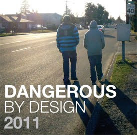
Transportation For America (T4 America) recently released their 2011 pedestrian safety report, Dangerous By Design 2011, which examines the problem of and offers solutions for the epidemic of preventable pedestrian deaths on our nation's streets. From 2000-2009, more than 47,700 pedestrians were killed and 688,000 were injured while traversing the country's roadway network. Given these statistics, the report asserts that the decades-long neglect of pedestrian safety in the design and use of America's streets is taking a heavy toll on our lives. Pedestrian deaths in the U.S. over the past decade are equivalent to a jumbo jet full of passengers crashing every month for the past ten years. The 688,000 injuries over this same period of time equate to a pedestrian being struck by a vehicle every seven minutes.

Nationwide, pedestrians account for nearly 12% of total traffic deaths, though state DOT's have allocated only 1.5% of available federal funds to projects that retrofit dangerous roads or create safe alternatives. In the nation's 15 largest metropolitan areas, pedestrian fatalities have actually increased over the past decade, even as overall traffic deaths fell. Children, older adults, and racial/ethnic minorities are disproportionately represented in these fatal statistics, but people of all ages and walks of life have been struck down in the simple act of walking.

The lack of federal funding dedicated to pedestrian improvements is mainly due to the perception that pedestrian safety is a local issue, even though 67% of the 47,700 pedestrian deaths over the past decade occurred on federal-aid roadways, major roadways eligible for federal funding for construction/improvements, and under federal guidelines for design. The majority of pedestrian deaths in the past decade share a common theme: though labeled as "accidents", they occurred along arterial roadways that were dangerous by design. These streets were engineered for speeding traffic with little or no provision for people on foot, in wheelchairs, or on bicycles.

Dangerous by Design 2011 also includes a ranking of the 52 largest metropolitan areas in the U.S. and how dangerous they are to pedestrians. The Orlando-Kissimmee, Florida metro area is considered the most dangerous, and three other Sunshine State metro areas are in the top five. The Philadelphia-Camden-Wilmington metro area is ranked 39 out of 52, in addition to having 3.8% of its population walking to work. Correspondingly, T4 America developed an interactive map to document the location of all pedestrian fatalities from 2001 to 2009.

T4 America makes several recommendations for provisions in the next Surfact Transportation Authorization bill to improve nationwide pedestrian safety along roadways. These recommendations include: retaining dedicated federal funding for safety of people on bicycle or foot (such as Safe Routes to School and Transportation Enhancements), adoption of a national complete streets policy, filling in strategic gaps in the pedestrian network, committing a fair share of federal funding to pedestrian safety, and holding states accountable for creating communities that are safe for walking.

Friday, May 13, 2011

New I-76 Ramp From Henderson Road [Video]

On May 4th at 11:00 a.m., PennDOT opened a new on-ramp to I-76 Westbound from the intersection of Henderson Road and South Gulph Road. This marks the successful completion of the first phase of the Henderson Road Ramps Project, a $10.5 million project funded by the American Recovery and Reinvestment Act (ARRA) to create a new interchange with I-76 Westbound in Upper Merion Township. PennDOT plans to open the new off-ramp from I-76 Westbound to Henderson and South Gulph Roads at some point in the Fall of 2011.

“This new interchange connects the westbound expressway with a key intersection in the King of Prussia area, and the new ramps will help relieve traffic pressure from the Gulph Mills Interchange,” PennDOT District 6-0 Executive Les Toaso noted.

The Upper Merion Transportation Authority partnered with PennDOT to provide preliminary design, environmental clearance, and right-of-way funding for the project. This allowed the project to achieve the “shovel-ready” designation necessary to receive funding under the federal stimulus program.

Immediately after opening the new on-ramp, PennDOT and Glasgow Inc., the general contractor, closed the existing on-ramp to I-76 Westbound from South Gulph Road near its intersection with Crooked Lane. As Tom Loughery of Glasgow Inc. explains to Ryan Jeroski of GVF in the attached video, the new on-ramp will provide motorist with a major upgrade over the older ramp. The new on-ramp is located at a signalized intersection, with a dedicated turn lane for those using the ramp, all of which was lacking in the old on-ramp. These upgrades will greatly improve traffic flow along South Gulph Road and safety for those turning on to the on-ramps.

Thursday, April 14, 2011

Dutch Astronaut Hopes to Revolutionize Public Transit [Video]

New transportation systems like BRT (bus rapid transit) and high speed rail are attracting a lot of buzz these days, but what if someone were to combine the two? That’s exactly what Wubbo Ockels, first Dutch astronaut and general manager of the Superbus Project has done:


The Superbus is the Ferrari of public transportation and is extremely cool looking; however that sleek, aerodynamic design is not just used for eye candy. Once implemented, the Superbus would have access to designated “Superbus tracks” where it could ramp up the speed to a blazing 155 mph between cities, an intriguing concept for cities where high speed rail isn’t an option.

While an interesting concept, a few key drawbacks will probably keep the Superbus from revolutionizing transportation. First is the economic feasibility in implementing a system like this. Who will ride it? The Superbus is currently being marketed as a luxury way to travel for the upper class, a demographic that tends to avoid public transportation. I am also not sure of how the public will perceive the safety of travelling 155 mph in a vehicle not attached to rails. It’s nice that the Superbus is an electric vehicle however this limits its range to 130 miles before it has to recharge, which will narrow potential areas the Superbus can be deployed.

Even with these drawbacks I still think that this project could be used as a valuable resource to transportation management, perhaps some ideas pioneered by the Superbus could be utilized in our next generation of transit systems.

More Information:

http://www.superbusproject.com/

Thursday, April 7, 2011

Amtrak Pursues High-Speed Rail Funding For NEC

Amtrak has recently filed an application for $1.3 billion in high-speed rail funding, from the pot of $2.4 billion turned back by the state of Florida, to upgrade its high-speed rail service along the heavily traveled Northeast Corridor. The funding would go towards a series of infrastructure improvements, including elements of Amtrak's Gateway Project, that would provide critical first steps to bringing high-speed rail service to the Northeast mega-region. The Gateway Project represents Amtrak's vision for next generation high-speed rail in the Northeast Corridor.


"The Northeast Corridor is a premier region in the country to advance the nation's high-speed rail program," said Amtrak President/CEO Joseph Boardman. "The Gateway Project improvements to increase passenger rail capacity and accesss into the heart of Manhattan are absolutely essential to make next generation high-speed rail a reality."


Amtrak worked closely with state partners to prioritize project selection in its application, ensuring that projects submitted by Amtrak were vital for the reliability and capacity of the current NEC network, in addition to being critical building blocks for expanded high-speed rail service.


The three Gateway Projects requests within the applicaiton include:


- A $720 million replacement of the more than 100 year-old movable Portal Bridge over the Hackensack River in New Jersey with a new, high-level fixed bridge. Amtrak has requested $570 million for this, and the state of New Jersey will contribute up to $150 million.


- A request of $188 million for preliminary engineering and environmental analysis for two new tunnels under the Hudson River into Manhattan with related infrastructure improvements.


- $50 million for preliminary engineering and environmental analysis for the development of a new Penn Station South facility to accomodate more tracks and platforms in downtown New York.


- $450 million to support capacity increases and improve trip times between Philadelphia and New York, one of the busiest sections of the NEC. The project will upgrade electrical power, signal systems, and overhead catenary wires in New Jersey and Pennsylvania to improve reliability, increase speeds up to 160 mph, and support more frequent high-speed service. Track switches at the western end of New York's Penn Station will also be reconfigured to avoid congestion issues.


Separate from the Gateway Project is an application for $15 million for the necessary environmental and preliminary engineering design to examine replacement options for the 100+ year-old, low-level movable Pelham Bay Bridge over the Hutchinson River in the Bronx on the Hell Gate Line that connects New York to New England.


Boardman emphasized that the Gateway Project is key for the future growth and economic development in the entire NEC region. The Gateway Project represents the cornerstone from which Amtrak plans to build a new, two-track 220 mph next generation high-speed rail system.

Wednesday, March 23, 2011

Montgomery County Community College featured in APTA magazine


The Montgomery County Community College was featured in the March 11 edition of the American Public Transportation Association's magazine, Passenger Transport. Passenger Transport is sent to companies, organizations and individuals throughout the United States. The article focused on the partnership between GVF and the College, and the details of the shuttle.

The shuttle is just one of the ways the College is fulfilling its promise and goal to reduce greenhouse gas emissions, since College President Dr. Karen Stout signed the American College & University Presidents' Climate Change Commitment in 2007.
As Dr. Stout quotes in the article, "This effort supports sustainability and student success by helping students gain access to courses required for completion of a degree that may be available at one campus and not the other."

To read the full article, click here.

Thursday, March 17, 2011

Miles Per Dollar vs. Miles Per Gallon

You hear it in every car commercial. Fantastic claims that their flashy new car gets excellent miles per gallon. It is a simple metric to calculate, take the number of gallons of fuel and divide it by the number of miles driven. Miles per gallon is a standard for measuring the efficiency of a vehicle against any other vehicle. If you are on the fence between an SUV or a sedan, the miles per gallon will be a consistent measure to clue you into the cost of driving. Miles per gallon has also become a bragging right for people with extremely efficient cars. Hybrid owners will turn their nose up in hubris as they proudly declare that they get 51 miles per gallon, then with a smug tone ask what your SUV gets.

What happens when you get your new car home? Does miles per gallon tell you how much your car is costing you? To know how expensive your commute is, or to decide whether to make a special trip for milk rather than stringing it as part of your next trip try calculating your Miles Per Dollar. Miles per dollar, much like miles per gallon is a measure that can be consistent across any vehicle, but what miles per dollar does better than miles per gallon is helps make transportation decisions. When we equate miles per gallon it assumes that we must drive, miles per dollar assumes we must travel. To calculate miles per dollar divide the total number of miles driven by the amount of money spent fueling your car. Example: If you drive 500 miles and it costs $75.00 to fill your fuel tank then your car gets 6.67 miles per dollar.

Once you are equipped with the knowledge of how expensive it is to drive, start considering alternative modes of transportation. For short trips, it will be more economical to leave the car at home and take a bicycle. For longer trips, taking SEPTA may pay off. If you can't take SEPTA or ride a bike, try carpooling.

Knowing your miles per gallon may give you something to brag about at your next cocktail party, but knowing your miles per dollar will save you money and make you a smarter traveler.


Friday, February 25, 2011

Is $53 Billion to Much For Our Future

In 1956 President Dwight D. Eisenhower signed the Federal-Aid Highway Act which created the interstate system. Ike's inspiration for the highway network came after after his 61 day journey in the United States Army Transcontinental Convoy that traveled from Washington D.C. to Gettysburg, then on to San Fransisco. The trip was a grueling journey, and later inspired President Eisenhower to begin the largest construction effort in the history of our nation. The result was the Interstate Highway System. Imagine if the convoy had used the rail system. Would Eisenhower put money into developing an interstate rail system?

Here we are, fifty-five years later deciding again whether or not to invest in and develop a network of high speed rail to connect our country in the same way the Interstate Highway System has. The problem is not a technical one, we have the engineers and technology to complete the system. The problem is a political one, we have differing opinions on the necessity. Our highway network is largely complete, and in dire need of repairs and upgrades. Congestion on many inter-urban corridors frustrates commuters, slows the movements of goods, and costs our nation in lost productivity.

President Obama has proposed a solution that will solve the problem of congestion and our dependency on oil. The National High Speed Rail Plan will reconnect cities, and offer incredible alternatives for mobility. His plan comes at a cost, $53 Billion, which is not a small figure. Compared to the $114 Billion spent on our Interstate Highway System, it doesn't seem as bad. For less than half what we spent to build highways, we can create a complementary system.

Many critics have said that this system is too costly, and that our nation can not afford to build high speed rail. What is not being discussed is the cost of inaction. The United States is the only nation in the world without a developed high speed rail system. Our reliance on oil has become our Achilles heal. While the rest of the world develops alternatives, we have been drilling deeper, only to find the wells are running dry.

Building a high speed rail network is critical for the future success of our nation. The construction will provide jobs in the present tense, it will develop opportunities for urban growth in the near future and it will bless the next generations with a mobility network that does not need to rely on a single source of fuel. Building the High Speed Rail network will carry a cost to our nation but make us stronger. Not investing in this system will not cost us much, much more.

Monday, February 7, 2011

GVF Named Gold Level Company by the Best Workplaces for Commuters

The Greater Valley Forge Transportation Management Association (GVF) is proud to be named a Gold Level Company by the Best Workplaces for Commuters. Best Workplaces for Commuters, a program designed to encourage sustainable transportation innovation and managed by the University of South Florida’s National Center for Transit Research, singled out 23 companies, institutions and individuals nationwide Tuesday in the 2010 “Race to Excellence” Virtual Awards Ceremony.

The awards recognize organizations who have taken exemplary steps to for their efforts to offer alternatives for their employees driving alone and thereby reduce air pollution, traffic congestion, and fuel usage from Jan. 1, 2010 to Oct. 15, 2010.

“We are very pleased to receive this recognition from the Best Workplaces for Commuters. We advocate for companies to implement commuting strategies and I’m happy to say we practice what we preach. We’re also honored to be included with companies like Microsoft, wonderful universities and the State of Arizona,” said Rob Henry, Executive Director of GVF.


Other companies that were recipients of the Gold Level include:
o Mayo Clinic (Rochester, Minnesota)
o Stanford University (Stanford, California)
o State of Arizona (Phoenix, AZ)
o University of North Carolina – Chapel Hill (Chapel Hill, NC)
o University of California – Irvine (Irvine, CA)
o Virginia Tech (Blacksburg, VA)

For more information about the Best Workplaces for Commuters program, visit http://www.bestworkplaces.org/.

If your organization is interested in becoming a Best Places for Commuters please contact GVF as we work with an organization to create a commuting program which saves money, reduces stress and improves the environment.


Design by Free WordPress Themes | Bloggerized by Lasantha - Premium Blogger Themes | Blogger Templates